Alabama turns retired gas rig into new reefs
A retired Gulf gas platform was transformed into offshore habitat, expanding fishing and diving opportunities while funding marine research and restoration.
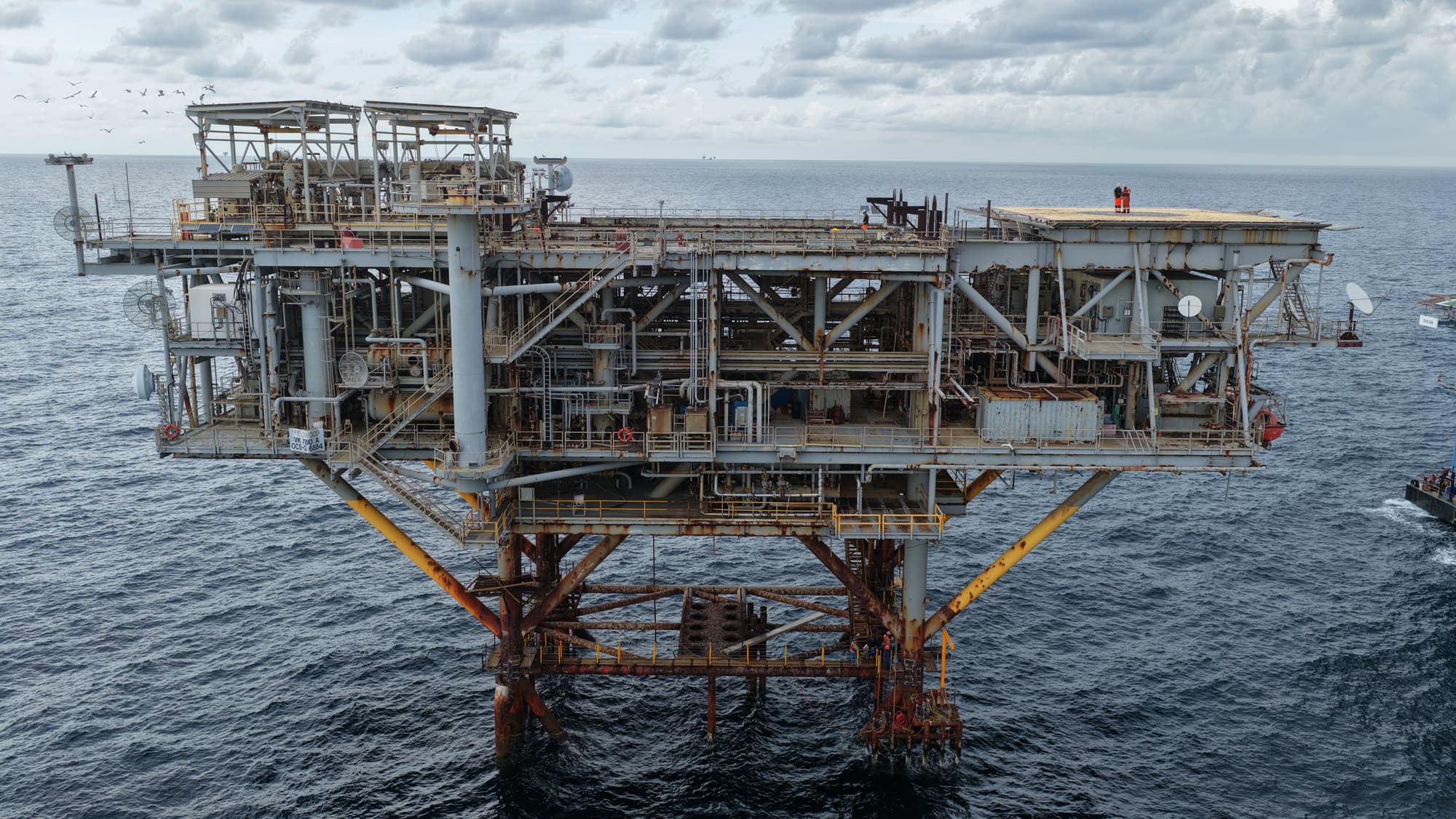
A decommissioned natural gas rig about 60 nautical miles south of Sand Island Lighthouse has been repurposed to create two new sites in the nation’s largest artificial reef program off Alabama’s coast through an agreement between the rig’s former owner, APA Corporation, and the Alabama Department of Conservation and Natural Resources.
The new reef sites, created from the Spirit VK 780A rig, are part of the state’s Rigs to Reefs program, which allows ADCNR to accept decommissioned oil and natural gas rigs as donations to Alabama’s artificial reef program.
Rigs to Reefs was implemented in 2013, when ADCNR Commissioner Chris Blankenship was director of the Marine Resources Division. The structures provide habitat for a wide variety of marine life, including many species of fish targeted by anglers.
In addition to donating decommissioned rigs, oil and natural gas companies are required to make monetary donations to MRD for research, monitoring, habitat restoration and management of Alabama’s marine resources. For this project, APA Corporation donated $1.5 million to MRD.
“Alabama’s Rigs to Reefs program allows us to keep these structures in the water to continue serving as productive habitat instead of being moved onshore,” Blankenship said. “The bases of oil and natural gas rigs in the Gulf are often called ‘islands of life’ because they support everything from corals to pelagic fish and sea turtles. Rigs to Reefs keeps these vital ecosystems in place while also allowing great fishing and diving opportunities. We are excited to add these large reefs to our already legendary Alabama Artificial Reef Program.”
To create the two new sites, the platform portion of Spirit VK 780A was removed and towed to shore for decommissioning. The remaining portions of the rig—the platform legs and well jacket—were cut at 90 feet below the water’s surface to allow for safe navigation above the new 400-square-foot reef zone established around the base of the rig.
The top portion of the rig, listed as VK 780-T on MRD’s offshore reef zone map, is a large rectangular artificial reef structure measuring 85 feet by 77 feet and extending 107 feet upward from the seafloor. VK 780-T is now located in 206 feet of water within the Tatum Winn South reef zone, 45.4 nautical miles south of Sand Island Lighthouse and 55 nautical miles southwest of the Perdido Pass farewell buoy.
GPS coordinates: N 29 25’ 46.752”, W 88 00’ 30.664”
The base of the rig, listed as VK 780-B on MRD’s offshore reef zone map, remains in 722 feet of water, 59.6 nautical miles south of Sand Island Lighthouse and 67.6 nautical miles southwest of the Perdido Pass farewell buoy. VK 780-B rises 632 feet from the seafloor and maintains habitat that has been growing on the platform since 1998.
GPS coordinates: N 29 14’ 14.973”, W 88 06’ 30.173”
Decommissioned oil and natural gas rigs create long-term, stable reef structures that can provide productive marine habitat for more than 50 years. MRD established the Marathon Reef and Swingle Reef from retired rigs in 1983. Those sites remain productive, functioning reefs more than 40 years later.
To learn more about Alabama’s Artificial Reef Program, visit www.outdooralabama.com/saltwater-fishing/artificial-reefs.